Crossing Chott el Jerid, the great salt lake
What is Chott el Jerid and is it worth stopping for?
Chott el Jerid is a huge, mostly dry salt lake between Tozeur and Kebili that most southern Tunisia routes cross on a raised causeway road. It isn't a destination with an entrance or a ticket — it's a landscape you drive through — but the white crust stretching to the horizon, the midday mirage and the roadside stalls selling salt-crystal 'desert roses' make the twenty-minute crossing worth doing slowly rather than at speed.
Chott el Jerid is not a place you visit so much as a place you drive across, and that’s exactly what makes it worth pausing for rather than treating as dead time between Tozeur and Kebili. The chott is a vast endorheic basin — a lake with no outlet to the sea — that spends most of the year as a cracked white salt pan spreading to a horizon with no obvious edge, and a shallow, mirror-flat sheet of brine after winter rain. The paved causeway road that crosses it is one of the more genuinely strange stretches of driving in Tunisia: no buildings, no trees, nothing but white crust and heat shimmer in every direction, with a handful of stalls selling crystallised salt formations to anyone who stops.
It sits on almost every southern Tunisia itinerary by default, since it’s the direct route between the Djerid oasis towns and the Nefzaoua region around Douz and Kebili. Few people plan a special trip around it, and that’s the right instinct — but slowing down for the crossing, rather than sleeping through it in the back of a minibus, turns twenty otherwise forgettable minutes into one of the more memorable stretches of a southern loop.
| Where | Between Tozeur/Nefta and Kebili, southern Tunisia, on the direct road south |
| Cost | Free to drive across; desert rose crystals from roadside stalls typically 5-20 TND (about €1.50-6) depending on size |
| Time needed | 20-30 minutes to cross on the direct causeway road; longer with photo stops |
| Getting there | Self-drive, taxi, louage or as part of an organised tour between Tozeur and Douz/Kebili |
| Best time | Midday for the strongest mirage effect; early morning or late afternoon for the best light and cooler stopping conditions |
What Chott el Jerid actually is
Chott el Jerid is the largest of a chain of salt lakes that runs across the pre-Sahara of southern Tunisia, spreading over several thousand square kilometres between the Djerid oasis region in the west and Kebili in the east. Geologically it’s a closed basin: water that drains into it from the surrounding hills and occasional rain has nowhere to go except evaporate, leaving behind a thick crust of salt and gypsum that whitens the surface for most of the year.
In summer, and in any dry stretch, the crust cracks into a mosaic of polygon shapes that can support a walking person near the road’s edge, though the ground beneath softens into treacherous mud further out, which is exactly why straying off the marked route is a bad idea rather than an adventurous shortcut.
After winter rain the picture changes considerably. A thin sheet of standing water can spread across large sections of the chott, sometimes only a centimetre or two deep, turning the pan into a genuinely striking mirror that reflects the sky and any passing cloud with almost no distortion. This state doesn’t last — the water evaporates back down to the salt crust within weeks in most years — so travellers hoping to see the flooded chott are somewhat at the mercy of when winter rain happened to fall relative to their trip, and it’s not something a tour operator can promise in advance.
The chott’s colour shifts through the day and with the amount of moisture present: bone white under a midday sun, tinged pink or orange at the edges from mineral deposits and algae in wetter patches, and capable of a genuine pale blue cast where standing water catches clear sky. None of this is staged or seasonal decoration — it’s a straightforward result of salt chemistry and light, but it photographs like something considerably more deliberate.
Crossing the chott: the road from Tozeur to Kebili
The most commonly used crossing is the paved causeway road (part of the GP16) that runs directly across the chott between the Tozeur/Nefta area and Kebili, roughly 90 to 100 km depending on your exact start and end points, with the actual open-water or open-salt stretch of the drive lasting around 20 to 30 minutes at a comfortable speed. The road is a single raised strip with the chott spreading away on both sides, no barriers beyond the road edge itself, and virtually no other structures until the roadside stalls appear partway across.
Self-driving the crossing is straightforward in ordinary conditions — the road surface is good tarmac, not sand or piste — but a few things are worth knowing before setting out. There’s no fuel available on the causeway itself, so fill up in Tozeur, Nefta or Kebili beforehand rather than assuming a station will turn up partway across.
Mobile signal is patchy in the middle stretch, and there’s essentially no shade or shelter if a vehicle breaks down, so it’s not the place to set off with a near-empty tank or a vehicle you’re not confident in. Our guide to driving in Tunisia covers what to expect on rural roads like this one more generally, and hiring a car in Tunisia is worth reading first if you’re planning to cross the chott independently rather than as part of a tour.
Travellers without their own transport typically cross as part of a taxi transfer, a louage route, or — most commonly — as one leg of an organised multi-day Sahara tour running between the Djerid oases and Douz or Kebili. A two-day Sahara exploration tour from Yasmine Hammamet or Sousse is one of the more accessible ways to see the chott crossing along with the desert beyond it, without needing to arrange the drive yourself from the coast.
The mirage, and when it’s strongest
The mirage effect that Chott el Jerid is known for is a straightforward optical phenomenon, not a local myth: heat rising off the hot salt surface bends light near ground level, which makes distant objects — a passing truck, a stall, the horizon itself — appear to float above a shimmering band that looks, at a distance, exactly like standing water. It’s at its strongest in the hottest part of the day, roughly between eleven in the morning and three in the afternoon, when the temperature difference between the ground and the air above it is greatest, and it largely disappears by evening as the surface cools.
Ironically, this means the best time for the mirage is close to the worst time for comfort — midday heat on an open salt pan with no shade is genuinely punishing for most of the year, so a stop built around seeing the mirage works best as a short one: pull over, watch the shimmer for a few minutes, take photographs, and get back into an air-conditioned vehicle rather than lingering. Early morning and late afternoon give softer, warmer light and a more comfortable temperature for photographs of the crust itself and the roadside stalls, even if the mirage effect is weaker at those hours.
| Time of day | Mirage strength | Comfort for stopping | Light quality |
|---|---|---|---|
| Early morning (7-9am) | Weak | Good, cool | Soft, good for photos |
| Midday (11am-3pm) | Strongest | Poor, very hot, no shade | Harsh, flat |
| Late afternoon (4-6pm) | Moderate | Good, cooling | Warm, good for photos |
Desert roses and the roadside stalls
Partway across the causeway, a handful of informal stalls sell what are sold locally as “desert roses” — rosette-shaped crystal clusters formed naturally by gypsum or, less often genuinely, selenite crystallising in salty, sandy ground. Genuine desert roses do form in this part of the Sahara, and some of what’s sold is real, but a fair amount of what’s on the stalls has been shaped, polished or assembled from smaller fragments to look more dramatic than what nature alone produced, so treat the more perfect-looking, symmetrical pieces with some scepticism.
Prices are informal and negotiable, typically running from around 5 TND for a small, rough piece up to 20 TND or more (roughly €1.50 to €6) for a larger, more elaborate cluster, and a little polite bargaining is expected rather than rude.
These stalls are also, practically speaking, the only place to stop along the crossing with anyone around, which makes them a natural rest point if you want to get out, stretch your legs and take photographs from ground level rather than through a car window. Vendors are generally low-pressure by Tunisian souvenir-selling standards, since foot traffic depends entirely on passing vehicles rather than a captive tourist crowd, but don’t expect a toilet, food or shade beyond a simple awning — bring water and don’t plan a long stop here in summer heat.
The northern route via Gabès: the longer alternative
Travellers who don’t want to cross the chott directly, whether out of caution about the road or simply because their route runs that way, can take the longer northern road via Gabès and Kebili’s outskirts instead, adding real distance and driving time in exchange for avoiding the open causeway. This route follows more conventional roads through towns and agricultural land rather than across open salt pan, and it’s the option most large tour buses and less adventurous self-drivers default to, particularly outside daylight hours when the causeway crossing is less appealing anyway.
| Route | Distance (Tozeur to Kebili) | Character | Typical time |
|---|---|---|---|
| Direct causeway across the chott | About 90-100 km | Open salt pan, minimal shade or services | Around 1.5 hours total |
| Northern route via Gabès | Considerably longer, well over 200 km | Conventional roads through towns | 3+ hours |
For most visitors interested in actually seeing the chott, the direct causeway is the obvious choice — it’s shorter, it’s paved, and it’s the whole point of including this stop in an itinerary. The northern alternative mostly matters for drivers who need to be in Gabès anyway or who are travelling after dark, when crossing an unlit salt pan road holds little appeal regardless of how good the tarmac is.
Combining the crossing with Tozeur, Douz and Kebili
Chott el Jerid sits almost exactly between two of the south’s main bases, which is why nearly every itinerary treats it as a link rather than a stop in its own right. Coming from Tozeur, the oasis town covered in our guide to Tozeur and the mountain oases, the chott is the natural next leg on the way toward Douz and the dune fields covered by our Douz gateway to the Sahara guide, or toward Ksar Ghilane further south, detailed in our Ksar Ghilane hot spring guide.
For a broader look at desert tours that include the chott as part of a longer route, a four-day tour discovering southern Tunisia typically loops through the Djerid oases, the chott crossing and the Nefzaoua region around Douz in a single structured itinerary, which is a reasonable option if you’d rather not plan the individual legs yourself.
Our Sahara tours from Tunis, compared guide runs through how different operators and durations stack up if you’re still deciding on a route, and the one week: Tunis and the Sahara itinerary shows how a chott crossing typically slots into a longer trip without eating into time better spent elsewhere.
Kebili itself, on the eastern side of the crossing, is a working provincial town rather than a tourist base, and most travellers pass through it quickly on the way to Douz rather than stopping — there’s little reason to linger unless you need fuel, an ATM or a meal before continuing.
Camel rides and desert stops near the chott
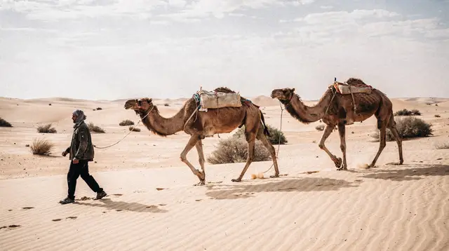
Some tours pair the chott crossing with a short camel ride or a stop at the dunes closer to Douz, on the logic that combining the salt pan with actual sand dunes in the same day gives a fuller sense of the region’s range of desert landscapes rather than just the flat white crust. A camel ride in the Sahara with hotel transfers from Douz is a straightforward way to add that contrast on the same day as a chott crossing, without needing to arrange transport separately once you’ve reached the Nefzaoua side.
For travellers who’d rather build in lunch and a longer ride rather than a short add-on, a Sahara desert camel trek with lunch from Douz extends the day considerably, giving more time on a camel and a proper meal break rather than a rushed photo stop. Either works as a natural continuation after crossing the chott from the Tozeur side, and our dedicated guide to camel trekking in the Tunisian Sahara covers the fuller range of options, from an hour near Douz to multi-day treks further into the erg.
Safety, heat and staying on the road
The single most important safety point about Chott el Jerid is straightforward: stay on the paved road and the marked stopping areas near the stalls, and don’t walk out onto the open salt crust away from where other people are standing. The crust that looks solid near the road’s edge can thin dramatically further out, especially after rain or in areas fed by underground moisture, and vehicles or pedestrians that break through into the mud beneath have genuinely become stuck in the past. There’s no rescue infrastructure out on the chott itself — help has to come from the road.
Heat is the other real consideration, and it applies for a large part of the year, not just in summer. There’s no shade anywhere on the crossing beyond a stall awning, and reflected light off the white salt surface adds to the direct sun in a way that makes the effective heat considerably worse than the air temperature alone suggests. Carry water in the car regardless of season, avoid extended stops between roughly eleven and three in high summer, and treat any breakdown on the causeway as a reason to stay with the vehicle and wait for help rather than setting off on foot in either direction.
Chott el Jerid rewards a short, deliberate stop far more than either racing across it or ignoring it as a place to sleep through — twenty minutes on a quiet stretch of road, watching a horizon that genuinely has nothing on it but white crust and heat shimmer, is a stranger and more memorable experience than its status as a mere connector between two towns would suggest.
Mistakes to avoid
Frequently asked questions about crossing Chott el Jerid
How long does it take to cross Chott el Jerid?
The direct causeway crossing between the Tozeur area and Kebili takes around 20 to 30 minutes of driving on the open salt-pan section, out of a total journey of roughly 90 to 100 km and around an hour and a half door to door. Add extra time if you plan to stop at the roadside stalls or pull over for photographs, which most travellers find worth doing rather than crossing without stopping at all.
Is Chott el Jerid actually water, or is it dry?
Both, depending on when you visit. For most of the year the surface is a dry, cracked salt crust, but after winter rain a thin sheet of standing water can spread across large sections, creating a genuinely mirror-like reflection that lasts only a matter of weeks before evaporating back to dry pan. There’s no reliable way to plan a trip around catching the flooded state specifically.
Is it safe to drive across Chott el Jerid yourself?
Yes, on the paved causeway road, which is a well-maintained standard road rather than a track across open sand or salt. The main precautions are practical rather than dramatic: fill up on fuel before setting out, carry water, and stay on the road and marked stopping areas rather than driving or walking out onto the open crust itself.
Can you swim or wade in Chott el Jerid?
No — even in its flooded state, the water is shallow, extremely saline and sits over soft, unstable mud rather than a firm lakebed, and wading out is neither pleasant nor advisable. Treat any standing water on the chott as something to look at and photograph from the road’s edge rather than somewhere to get in.
Are the desert rose crystals sold at the stalls worth buying?
They’re an inexpensive, genuinely local souvenir, and many of the smaller, rougher pieces are authentic gypsum formations from the surrounding desert. Larger, unusually symmetrical clusters are worth a more sceptical eye, since some are shaped or assembled rather than found exactly as sold — buy for what you like the look of rather than as a certified geological specimen.
Does every southern Tunisia tour cross Chott el Jerid?
Most multi-day Sahara tours that link the Djerid oases (Tozeur, Nefta) with the Nefzaoua region (Douz, Kebili) use the direct causeway crossing, since it’s the shortest practical route between the two areas. Some shorter day tours based purely around Tozeur or purely around Douz may not include it at all, so it’s worth checking an itinerary in advance if seeing the chott specifically matters to you.
What should I wear or bring for a stop at the chott?
Sun protection matters more here than almost anywhere else in southern Tunisia, since there’s no shade and the white salt surface reflects a significant amount of additional light and heat. A hat, sunglasses, sunscreen and water are the practical essentials; closed shoes are more comfortable than sandals if you want to walk a short distance from the road onto the firmer edge of the crust near the stalls.
Is Chott el Jerid connected to the Star Wars filming locations in southern Tunisia?
The chott sits close to the Djerid region, which film productions have used for desert scenes over the decades, though the best-known and most deliberately preserved sets are further south around Matmata and Tataouine rather than on the chott itself. Our dedicated guide to Star Wars filming locations in southern Tunisia covers where the actual film sets sit relative to a Tozeur-Douz route like this one.
Sahara desert tours on GetYourGuide
Verified deep-linked GetYourGuide tours. Book through these links and we earn a small commission at no cost to you.
These are our own photographs of Tunisia, not the operator's pictures of this tour — open the tour page to see those.